

This article was originally published on January 28, 2021 on The Restless Viking website.
In preparing for our winter escapade to Mackinac Island, I researched the fascinating history of the area. This is the first in a series of articles about the island and the people who have called it home.
 Anishinaabe Thunderbird
Designed by freehand sign painter
Grand Chief Ben Wawia
The Anishnaabek (also known as the Odawa, Ojibway and Potawatomi) tribes inhabited the Mackinac Island area for thousands of years. They hold the beginning of the story to the island. With its central location, Mackinac Island had served as a meeting place for tribal groups from the area. Round Island, Bois Blanc Island as well as Mackinac Island each have been sites for ceremonial burials and are considered sacred.
Mackinac means “Great Turtle” so “Turtle Island” is a nickname that remains today. The Anishnaabek tribes tell the story of how Mackinac Island was the first land on Earth. Seeing how tired his friends were, a turtle allowed several of his cohorts to try to retreive soil from the bottom of the lake to place on his back, creating land. Finally a muskrat was able to accomplish the task building a space for the creatures to rest. From a distance Mackinac Island resembles the shape of a turtle.
 Mackinac means “Great Turtle”
Why are there so many different spellings of the tribal names? Well, the European settlers struggled to label and categorize the names they heard. It was recorded as Ojibwe to Jibwe, to Chipwe, Chippeway, Chippewa. Today most natives prefer to be called Anishnaabek.
There are three main tribes which inhabited the northern area of Michgian: Potawatomi (Bodawotomi), Chippewa (Ojibwe) and Ottawa (Odawa). They form the “Three Fires Council.” There are some differences among these similar tribes.
The Potawatomi encouraged political unity among the northern Michigan tribes. When this didn’t work out well and they were seeking a more mild climate, the Potawatomi relocated to the Kalamazoo/St. Joseph area. With the rivers providing sustaining fish, they had a more stable food supply thus were able to be sedentary. The Potawatomi tribe was known for their refined use of medicinal herb gardens in addition to growing squash, beans, and corn.
The Chippewa people occupied most of the Upper Peninsula and the eastern half of the lower peninsula. Following their food sources of fish and game, they relocated their villages throughout the seasons. The Chippewa were masters at using plants and herbs as medicine. After trading furs with the French, they took up arms against the English in the colonial conflicts.
The Ottawa tribe was nomadic in the western half of lower Michigan. They were highly skilled and known for their birch bark canoes. Their animal traps could catch moose, caribou and deer as well as smaller game. Their fish nets were successful, too. Tribe members collected wild rice as another food source. Although they were talented in the fur trading economy, the Ottawa did not side with either of the European settlers. Rather, they preferred to clash with their native counterparts for territory in northern Michigan.
I have great admiration for these people who were able to survive using natural resources. It makes me appreciate the ease and conveniences we have these days.
French explorers set foot on Mackinac Island in 1634 calling the northern Great Lakes region, “New France.” Father Marquette, a French-Canadian Jesuit priest and Catholic missionary, moved to Mackinac Island in 1669. He continued exploring and mapping the northern region of Michigan and Wisconsin, as well as the Mississippi River. He following the river south for hundreds of miles. Father Marquette left a firm impression on the settlers who have named parks, a river and a city for him.
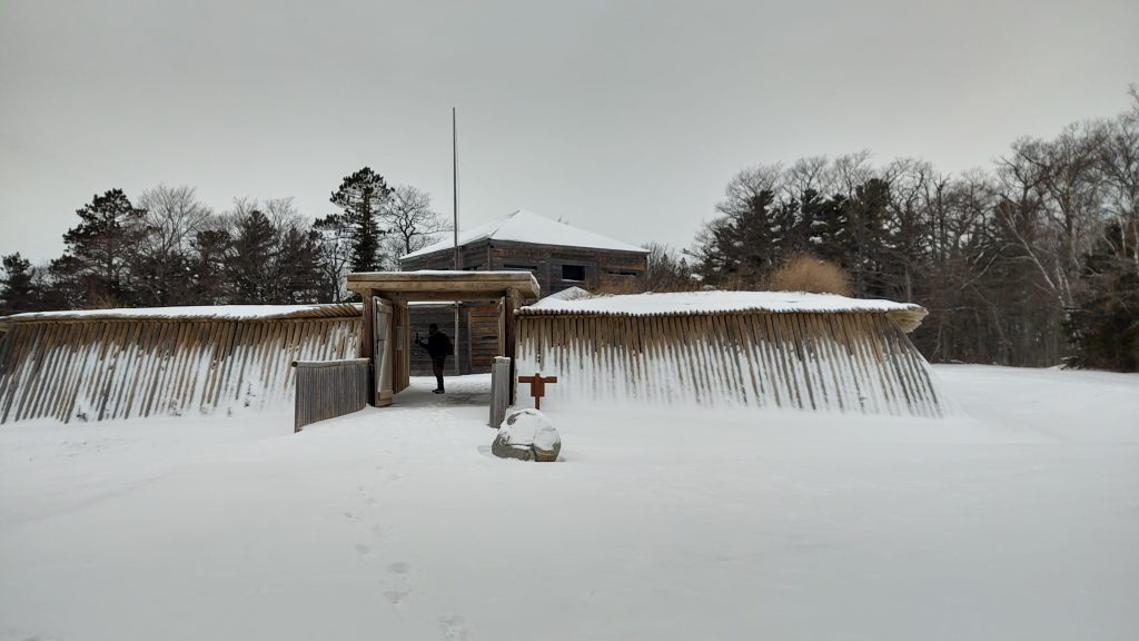
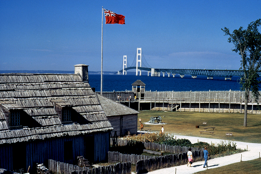 Fort Michilimackinac (looking northeast) is at the northern tip of the lower peninsula.
Photo Credit: Military History of the Upper Great Lakes
In 1715 Fort Michilimackinac, on the mainland (in Mackinaw City), was built by the French to protect the vigorous fur trade. The fur trade economy continued to be profitable into the 19th century. Michilimackinac is a native word meaning “great snapping turtle.”
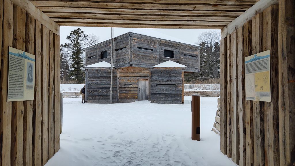
The French and Indian War from 1754 -1763 resulted in the British gaining control of the Fort Michilimackinac. The battles were vicious. The French had encouraged the Chippewa (Ojibwe) Tribe to fight against the British. “Pontiac’s Rebellion” was a movement where the Chippewa fought against the British troops at forts across the Northern Michigan region.
One noted battle was on June 2, 1763. The British troops watched tribe members play baaga’adowe (similar to lacrosse) just outside the gates of Fort Michilimackinac as they often did. (The fort was on the mainland where Mackinaw City is today.) However, this game was designed as a diversion. The ball went over the fence and landed inside the fort. The British opened the gates so the Chippewa (Ojibwe) men could retrieve their ball. The Native women who were also spectators swiftly handed their men hatchets and spears which they had concealed under their shawls. This attack on the British was known as the Massacre of Michilimackinac.
Today actors portray life as it had been under British colonial rule allowing tourists to experience the past. Soldiers are dressed in “red coats” and fire cannons at appointed times throughout the day.
In 1780 the British built Fort Mackinac on Mackinac Island (northwest of Fort Michilimackinac) to more thoroughly defend the waterways which was a vital supply route and shipping channel.
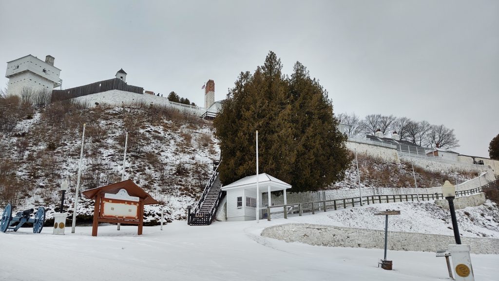
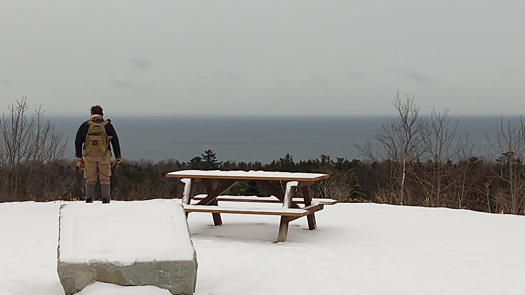
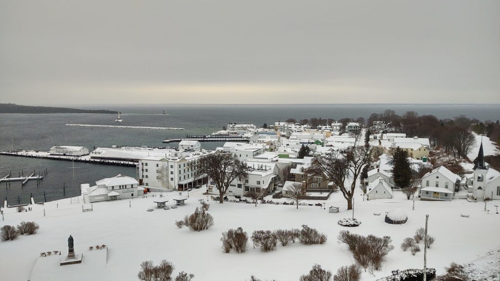 This is the view from the top of Fort Mackinac on Mackinac Island.
 This is the front of Fort Mackinac.
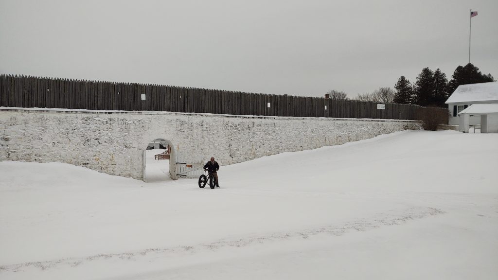 Here is the back of Fort Mackinac with Chuck ready to mount his winter-tire bike.
The British felt vunerable along the back side of the fort, so they constructed Fort George up on the hill behind Fort Mackinac.
 In 1814 Fort George was built by the British at the highest point on Mackinac Island, honoring King George III. Funds to rebuild this structure for its bicenteniel were appropriated in 2014.
 The inner structure allowed for a wide-scope view of the straights.
This provided a strategic look out over the Straights of Mackinaw. With easier sightings of enemies approaching, the British could launch more effective defense maneuvers.
 The eastern view provided the expanse of the straights from Fort George,
which was later named Fort Holmes.
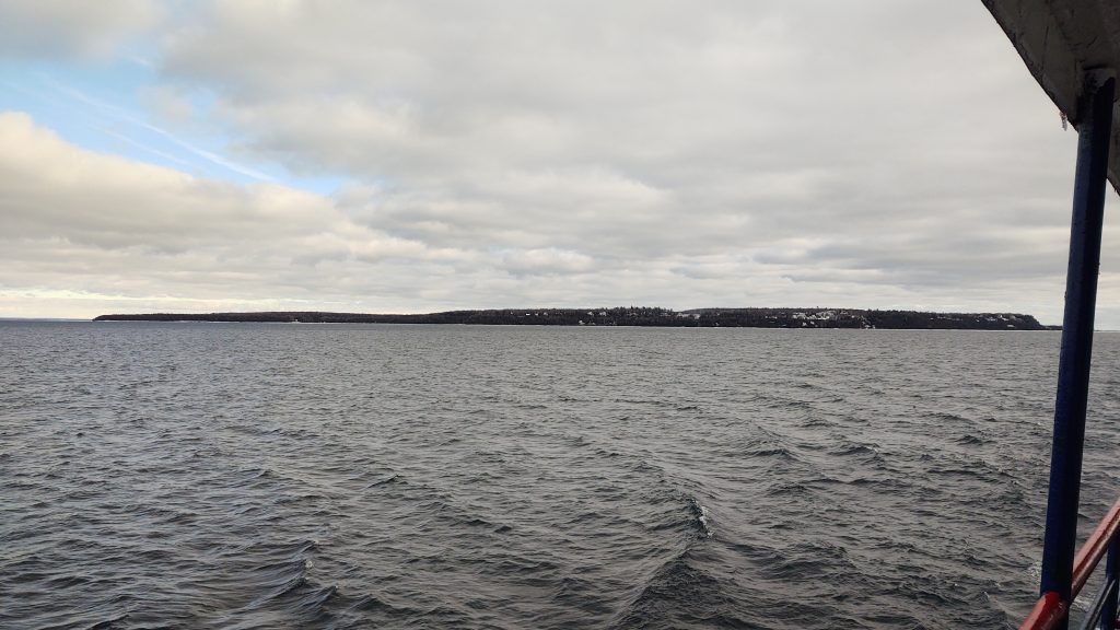
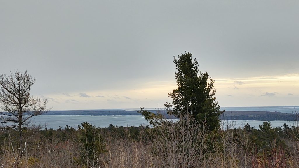 The western view reveals Round Island (foreground – right) and Bois Blanc Island (left).
Bois Blanc Island supplied the wood for the fort.
Years following the Revolutionary War, the British still lived at Fort Mackinac until 1796 when they were forced to leave by decree of the Jay Treaty. The Americans took control.
Dick Posthumus helped to clarify the timeline of events in an email, “In one of the first land war actions of the War of 1812, the British landed on the opposite side of the island (from the fort) at night and moved to the highest point (what became Fort George and Fort Holmes later) and established cannons to gun down on Fort Mackinac. The Americans surrendered the Fort and the Island to the British which they held until the end of the War of 1812. It was after they captured the Island that they built the new fort (George and then Holmes) in 1814 at the high point. The British were then forced to return the fort to the Americans under the Treaty of Ghent ending the War of 1812. ” This island fortress was officially named Fort Holmes in 1820 honoring the U.S. Army Major Andrew Hunter Holmes who had been killed there in 1814.
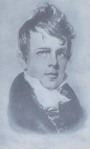 Major Andrew Hunter Holmes
In the Treaty of Washington in 1836 the native tribes relinquished their hold of the Northern lower peninsula and the eastern upper peninsula regions. The Odawa and Ojibway were then threatened by the government to be removed from the land that had been theirs for generations. The tribes managed to stay through the 1900’s but sadly have had to continue to fight for their rights ever since.
Around the mid 1800’s the fur trade began to decline while tourism began to grow. Investors wanted to make Mackinac Island an enticing place for travelers. In the 1880’s railroad companies built 1,400 expansive hotels to encourage people to visit the wilderness areas. The Grand Hotel was one of these built in 1887 making Mackinac Island a desired destination.
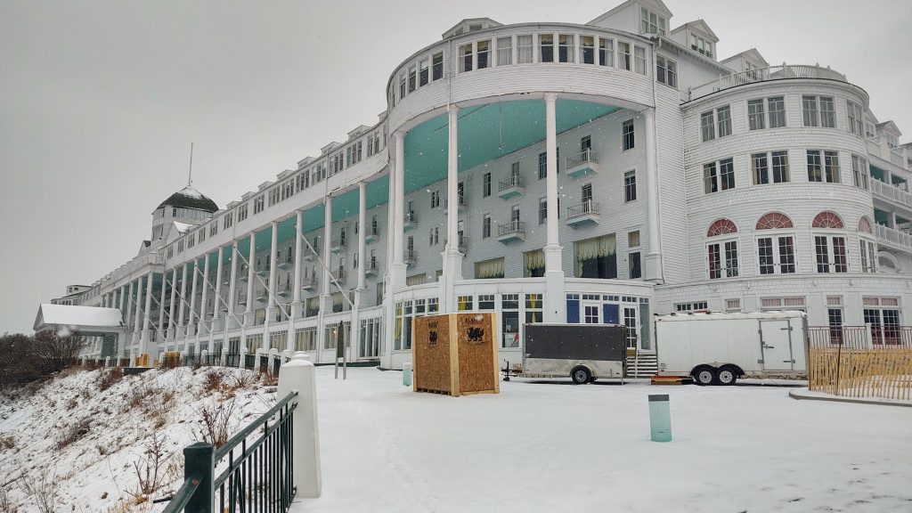 Winter is The Grand Hotel’s construction season.
Automobiles, which were excitingly new at the time, were banned from the island in 1898 keeping the Victorian nostalgia of horse drawn carriages and bicycles as modes of transportation.
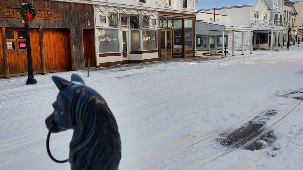 May’s Fudge Shop (center – white building) is ran by Heather, a fifth generation candy maker.
Fudge shops developed ceiling fans to send their fudgy fragrances out into the street. This enticed the crowds to seek the tasty treat and to witness the making of fudge in shops on large marble slabs.
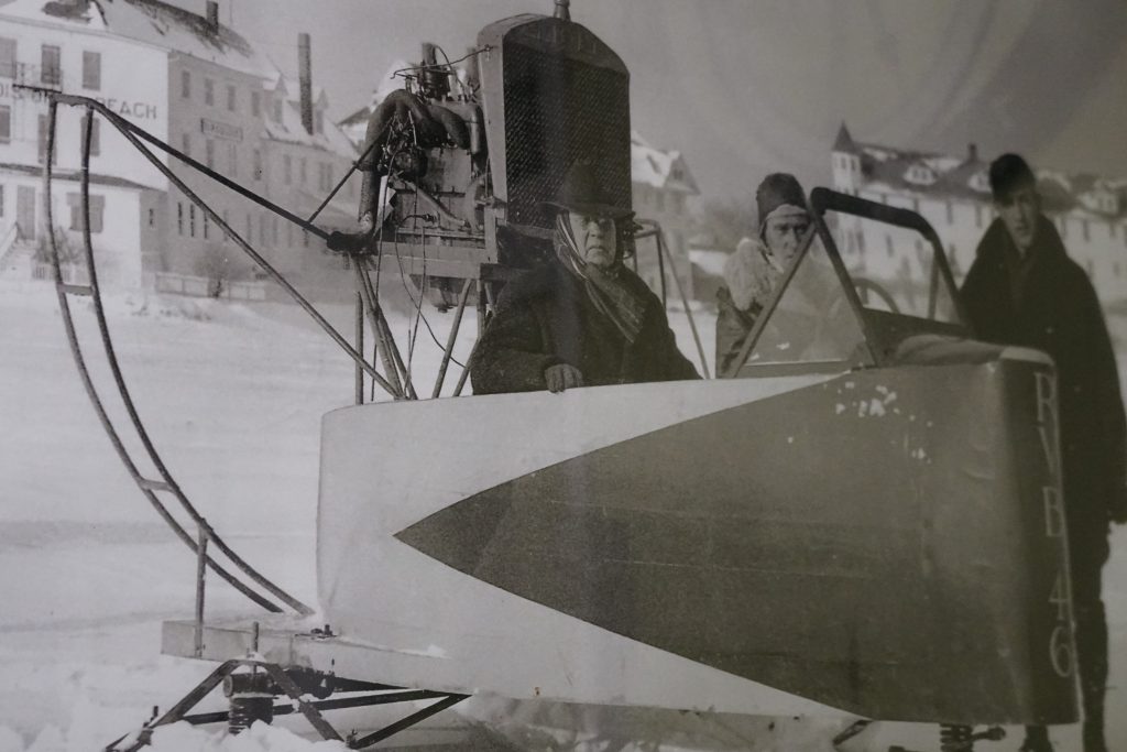 One of the first “snowmobiles” on Mackinac Island.
Photo Credit: Doud’s Market
According to 2010 U.S. Census figures, about 20 percent of Mackinac Island’s population are year round residents. “We get stuck in the 1800s and left it there,” Hemenway, a native historian, stated. “The Ojibwa and the Odawa are still living in the Straits until this very day.” (Mar 7, 2017)
What is life like today for the 500 year round residents on the island? Well, we were curious and have interviewed a few people including Amy Peterson who is the Superintendent/ Principal/ Athletic Director for the Kindergarten through 12th grade school serving the island community.
Chuck and Martha Hayden, aka The Viking and Poppins, enjoy going on adventures off the beaten path. They also like to share their explorations with others. The Viking is a retired expedition leader while Poppins is a retired teacher. The two offer independent views of their journeys showcasing places, people, and cultures as they explore the world. Visit and follow them on their website and social media accounts. Website | Facebook | Instagram |YouTube
Leave a Reply